Formosa in the regional connectivity network: methodological proposals and traffic management strategies
Main Article Content
Abstract
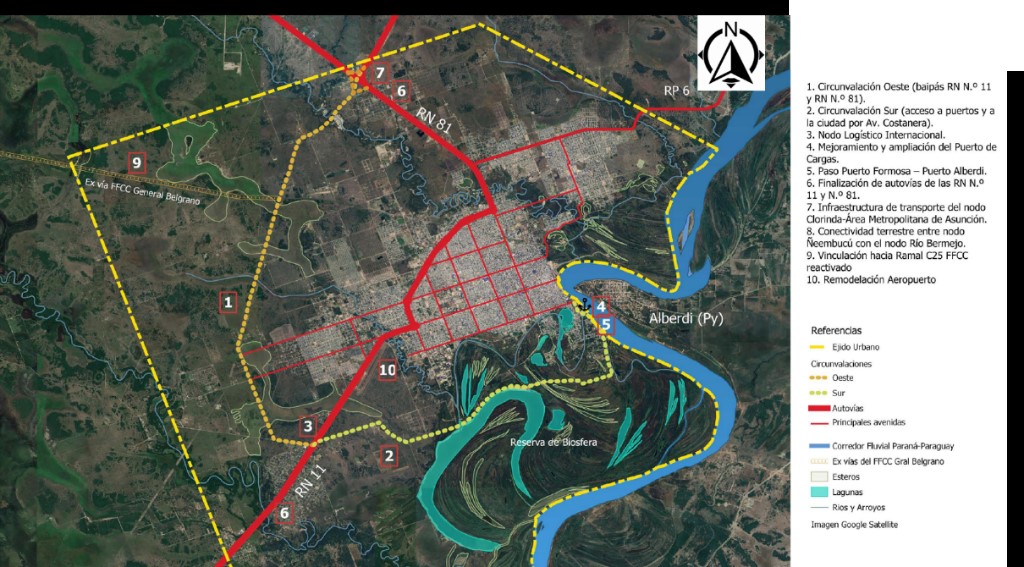
The city of Formosa, strategically located in northeastern Argentina and part of the Bioceanic Corridor, plays a key role in regional and international connectivity. This multimodal corridor includes Gendarmería Nacional Avenue, a vital artery for transporting goods and people, linking the provinces of the "Gran Norte" with other South American regions and strengthening territorial value chains. However, demographic growth, urban sprawl, and private vehicle dependence present significant challenges for mobility. This study analyzes traffic at a key intersection—comprising a signalized roundabout and a multi-level interchange. Given the increase in vehicles, heavy motorcycle use, and public transport limitations, traffic conflicts were identified stemming from vehicle fleet characteristics and user behavior. Calibrated and validated simulations using local data led to proposals aimed at improving traffic efficiency, reducing travel times, and ensuring road safety. This approach offers viable, replicable solutions for similarly structured urban contexts.
Article Details

This work is licensed under a Creative Commons Attribution-NonCommercial-ShareAlike 4.0 International License.
Los contenidos de la revista están protegidos bajo la licencia Creative Commons Atribución-NoComercial-Compartir Obras Derivadas Igual 4.0 Internacional (CC-BY-NC-SA 4.0). Esta licencia permite compartir, copiar, distribuir y transformar las obras, bajo las siguientes condiciones:
- Citar la autoría y fuente original.
- Mantener los mismos términos de la licencia en las obras derivadas.
Los editores están autorizados a depositar y difundir los trabajos en bases de datos y redes sociales, con el objetivo de aumentar su visibilidad.
Términos de la licencia: http://creativecommons.org/licenses/by-nc-sa/4.0/deed.es

