Territorial transformation and water risk: geospatial analysis of urban expansion in Eastern chaco, Argentina (2000–2020)
Keywords:
urban expansion, land use, water risk, Eastern Chaco, geospatial analysisAbstract
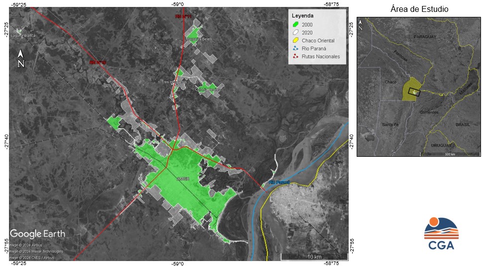
Eastern Chaco, shaped by fluvial dynamics, hosts a complex network of wetlands and water bodies influenced by the Paraná and Paraguay rivers. These hydrological systems create a mosaic of aquatic and terrestrial ecosystems. This study analyzes land use in the departments of San Fernando, 1º de Mayo, and Bermejo, located between the Paraná-Paraguay rivers on the East and National Road 11 on the West. This area has been designated a Chaco Wetlands Site since 2004. The research maps urban land use evolution, focusing on expansion, densification, and sprawl. Using satellite imagery and geospatial technologies, it examines the impact of urban growth on environmental equilibrium, particularly in flood-prone areas. This geographic, systemic approach provides an essential cartographic base for future territorial planning in this key region of northeastern Argentina.
Downloads
Downloads
Published
Issue
Section
License

This work is licensed under a Creative Commons Attribution-NonCommercial-ShareAlike 4.0 International License.